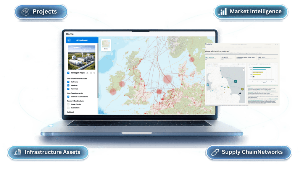
Olsights is working with the National Energy System Operator (NESO) on VECTOR, Viability Evaluation of Carbon Transport Options & Routes, an innovation project exploring how connected data, evidence-led assessment and interactive spatial tools could help decision-makers understand the development and potential viability of future carbon capture, transport and storage infrastructure.
MapStand is supporting the project as a delivery partner, contributing specialist energy infrastructure data and spatial analysis capability.
Carbon capture and storage (CCS) presents a particularly complex infrastructure planning challenge. Potential sources of CO₂ capture are distributed across industrial clusters and individual sites. Transport may involve pipelines, shipping or combinations of the two. Storage resources are predominantly located offshore, while projects across the capture, transport and storage chain can have different development timescales, capacities and commercial dependencies.
Understanding whether a potential CCS pathway is viable therefore depends on looking at the whole chain, rather than considering individual assets or projects in isolation.
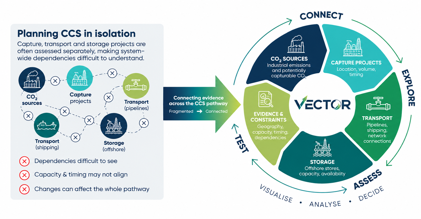
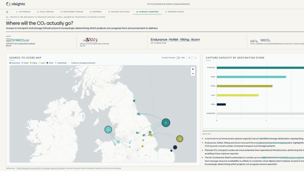
Connecting the CCS pathway: VECTOR is exploring how CO₂ sources, carbon capture projects, transport infrastructure and offshore storage can be assessed together to better understand capacity, timing, dependencies and potential delivery risks.
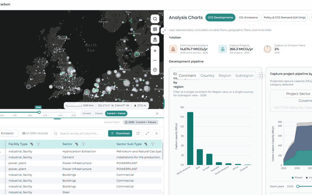
VECTOR will investigate a more consistent, bottom-up approach to assessing CCS development as an integrated whole-system pathway. It will explore how capture sources, transport infrastructure and storage locations can be brought together within an intuitive, interactive spatial environment – allowing the relationships and dependencies between them to be more easily understood.
The aim is to enable users to explore questions such as:
- where significant potentially capturable sources of CO₂ are located;
- how those sources might connect to transport infrastructure and offshore storage;
- where geographic, capacity or timing constraints could arise;
- how alternative network configurations could be explored;
- where dependencies and potential delivery risks may exist; and
- how changes or delays in one part of the chain could affect other connected projects.
The project is deliberately exploratory. Rather than attempting to prescribe what Great Britain’s future CO₂ network should look like, VECTOR is intended to establish how better data integration, spatial analysis, evidence-led assessment, visualisation and rapid scenario exploration could support strategic carbon system planning and deliverability.
During the initial six-month phase, the project will develop and test a methodology, underlying data model and approach to assessing viability and delivery risk. These will be brought together within an interactive demonstrator and tested with users to understand which capabilities and information provide the greatest value.
“Once the ‘easy’ decarbonisation of power, transport and heating is done, then carbon removals are expected to be the ‘balancing mechanism’ of net zero – although currently a very uncertain one. We want to test how piecing together the deliverability of full-chain CCS disposal systems and bio-CO2 usage options from available evidence – into bottom-up planning pathways for this important Vector – could ultimately support NESO’s strategic energy planning initiatives. This is an exciting opportunity for us that builds on previous energy network innovation and decades of gas system know-how, and we’re grateful that NESO are placing their trust in innovative British SMEs to deliver this work.” Tony Griffiths CEO, Olsights
Olsights’ role
Olsights is leading the development of the project’s visual decision-intelligence approach, combining energy-system data, spatial analysis, evidence-led assessment, user discovery and rapid prototyping.
Our role is to translate a highly interconnected infrastructure problem into something planners can see, explore and interact with.
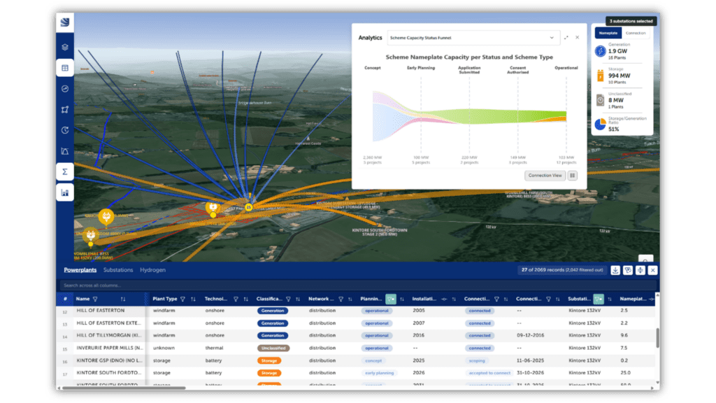
That means moving beyond a conventional static map. VECTOR will explore an environment in which users can investigate potential infrastructure pathways, test assumptions, identify dependencies and better understand how changes in one part of the system could affect another.
The work also builds on experience from Olsights’ previous network-planning projects, particularly REACT, which demonstrated how interactive visual tools can help users move between strategic, geographic and asset-level questions without requiring specialist GIS expertise.
VECTOR extends that thinking into a different whole-system challenge: understanding how potential CO₂ capture could connect with the infrastructure needed to transport and store it and how the evidence surrounding those connections could help assess viability, constraints and delivery risk.
Working with NESO and MapStand
As Great Britain’s independent energy system operator and planner, NESO brings a whole-system perspective to the project and provides the strategic planning context within which VECTOR is being developed.
NESO’s involvement helps ensure the work is grounded in genuine system-planning questions and user needs rather than developing technology in isolation.
MapStand joins the project a delivery partner, bringing specialist capability in energy infrastructure data, spatial analysis and the representation of complex infrastructure networks. Its contribution supports the project’s ability to bring together geographically distributed assets, projects and potential network relationships within a coherent spatial context.
Olsights brings the complementary capability to translate those planning questions, evidence and datasets into intuitive visual concepts and interactive prototypes, allowing ideas to be developed and tested rapidly with users.
Together, the project combines strategic system-planning expertise, infrastructure and spatial data capability, and visual decision intelligence.
This innovation-led approach is central to VECTOR. Rather than beginning with a predetermined software solution, the project is intended to establish which capabilities are genuinely useful, what information is needed to support them and where further development could create value.
“Through the NESO led VECTOR innovation project, we’re accelerating more joined-up whole energy system planning. We’re testing a pioneering methodology to assess carbon capture, transport and storage infrastructure, and harnessing connected data and visualisation to bring the full CO₂ chain into view. VECTOR will explore how clearer, evidence-led insights can reveal opportunities, constraints and delivery risks earlier, supporting better-informed strategic planning decisions as future CO₂ networks take shape.”
Why VECTOR matters
The development of carbon capture and storage will depend on multiple industries, infrastructure providers and projects making interdependent decisions over many years.
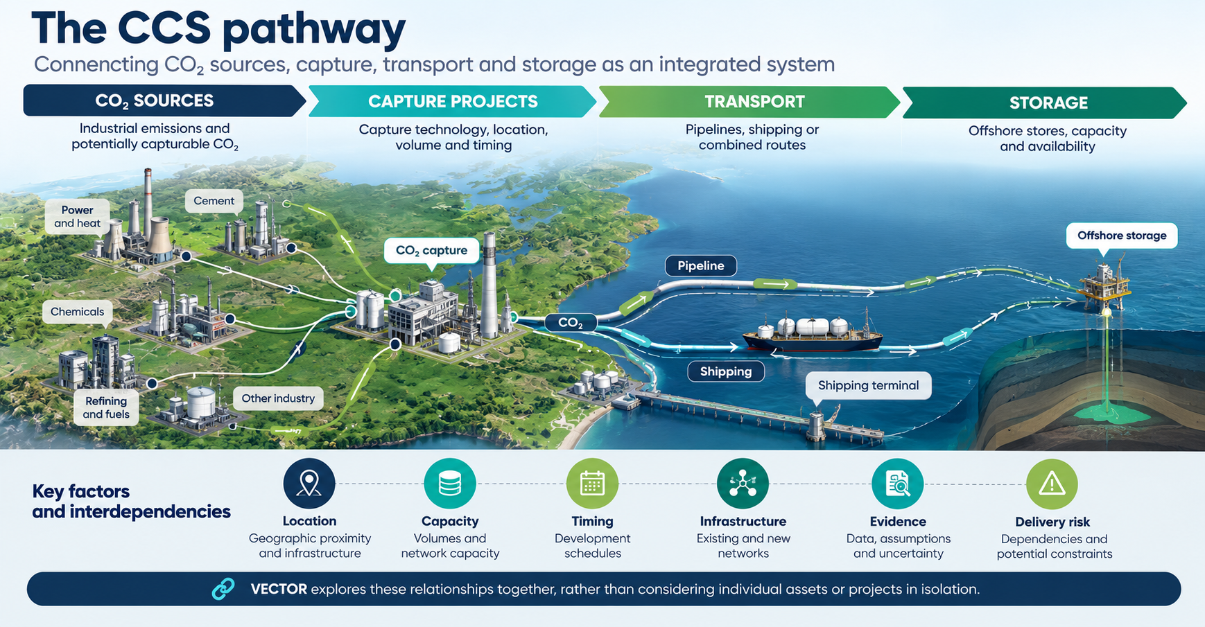
VECTOR explores the relationships and dependencies between CO₂ sources, capture projects, transport infrastructure and offshore storage as an integrated CCS pathway.
A capture project may depend on transport capacity that does not yet exist. A transport network may depend on sufficient future volumes to justify investment. Storage development may need to accommodate projects emerging at different locations and at different times.
These are spatial, temporal and commercial questions as much as engineering ones.
Being able to understand those dependencies together could help planners identify potential opportunities, constraints, delivery risks and coordination challenges earlier.
VECTOR is therefore exploring a simple but important idea:
If the future energy system is increasingly interconnected, the tools used to plan it should make those connections visible.
The initial phase will provide evidence and user feedback to inform recommendations for the potential future development of the approach.
For Olsights, VECTOR represents another step towards our wider goal of helping organisations understand complex infrastructure systems through intuitive, evidence-led visual decision tools.
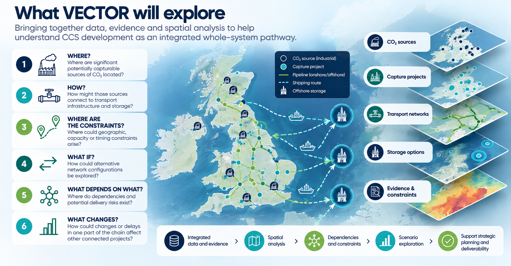
VECTOR – Whole-System CCS Planning & Spatial Analysis